
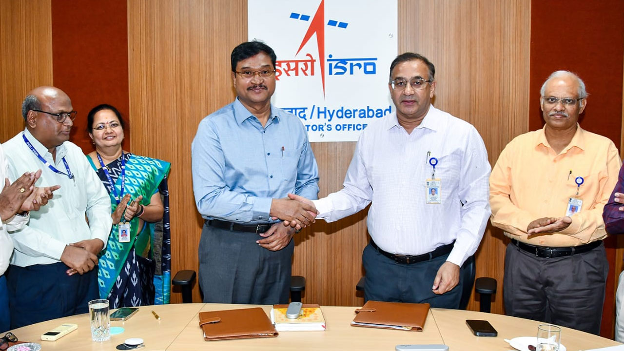
In a significant step toward transparent urban planning, HYDRAA (Hyderabad Unified Metropolitan Transport Authority) signed a Memorandum of Understanding (MoU) with the National Remote Sensing Centre (NRSC) on Friday. The collaboration aims to make land-related data within the Outer Ring Road (ORR) accessible to the public in a simplified and geo-tagged format.
Table of Contents
Clear Boundaries, No Room for Confusion
HYDRAA Commissioner A.V. Ranganath and NRSC Director Dr. Prakash Chauhan signed the MoU. The primary goal is to provide accurate data regarding lakes, buffer zones, government lands, and parks with clear boundary demarcations, eliminating any ambiguity in land-related matters.
NRSC to Provide Geo-Spatial Data Support for Disaster & Water Resource Management
Under the MoU, NRSC will provide HYDRAA with the following technical support:
- Geo-spatial data for disaster management and water resource protection.
- Integration of remote sensing and GIS technologies to develop a comprehensive geographic database for the Telangana Core Urban Region (TCUR).
- Access to heritage data related to disaster management and water bodies via the Bhuvan Portal for areas within TCUR.
- Satellite data under the new ‘Geospatial Data Policy – 2023’ will be made available through the ‘Bhu-Nidhi’ portal.
- High-resolution satellite imagery, aerial photography, and digital elevation models.
- Technical assistance in creating, integrating, and managing asset-related data.
- Free access to NRSC’s ‘National Database for Emergency Management’ (NDEM) portal for real-time aero-space based visualization of disaster data.
First-of-its-Kind Initiative in Telangana for Lake Restoration & Land Protection
Dr. Prakash Chauhan emphasized that this large-scale initiative would make Telangana a pioneer in satellite-supported lake restoration and environmental protection. He expressed confidence that Hyderabad could become one of the most sustainable cities in India if such efforts continue.
27 Municipalities Around GHMC to Be Covered
As part of the agreement, HYDRAA and NRSC will work together to collect and analyze data related to lakes, government lands, and parks in 27 municipalities and corporations surrounding the GHMC limits. This comprehensive information will soon be accessible to the general public.