Bathukamma Kunta Is a Lake: HYDRAA Commissioner Shows 1975 Records & Satellite Proof
HYDRAA Commissioner AV Ranganath confirms Bathukamma Kunta as a lake with satellite proof. 2,093 acres reclaimed, court process ongoing in Hyderabad.
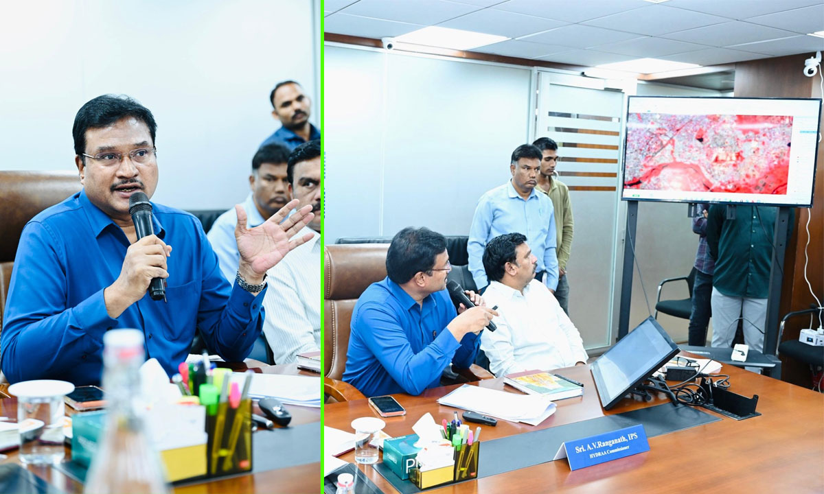
Hyderabad: HYDRAA Commissioner A. V. Ranganath clarified that Bathukamma Kunta in Amberpet is unquestionably a lake, presenting historical records, satellite images, and Google Maps evidence.
Table of Contents
Speaking to media at the HYDRAA office on Saturday, he issued a clarification following recent news reports and rumors. He stated that gates and boards were removed as per court directions, and the matter is currently under legal process, with an affidavit to be filed within 3 weeks as directed by the Supreme Court.
Historical Records and Satellite Images Released
The HYDRAA Commissioner presented detailed evidence:
- 1975 irrigation records clearly classify Bathukamma Kunta as a lake
- In Survey No. 563/1, the lake extent is 9.19 acres as per revenue and GHMC records
- The lake bund exists in Survey No. 563/2, measuring 6 guntas, referred to as Masan Katta
Additional evidence released:
- Survey of India photos (1971)
- NASA (Landsat) satellite images (1989)
- A comparative video based on these images
Court Orders and HYDRAA Action
The Commissioner stated:
- Until final judgment, no individual should claim ownership over Bathukamma Kunta
- Based on this, boards and gates were removed
He further added:
- HYDRAA informed the Supreme Court that removing fencing around the lake may lead to dangerous situations
- The court directed HYDRAA to submit an affidavit within 3 weeks (on Monday direction)
He also recalled:
- In the Salkam Cheruvu case in Bandlaguda Mandal village, the court did not hold HYDRAA at fault
- The High Court order noted that HYDRAA sought details and actions will follow based on irrigation and revenue reports
“Lakes Are Public Property”: HYDRAA Commissioner
A. V. Ranganath emphasized:
- All lakes belong to the public, irrespective of private or government claims
- Farming near lakes is allowed only when water levels reduce
- No construction is permitted that alters the nature of lakes
This clarification came in response to complaints that:
- Some gated communities are blocking public access to lakes
Lake Restoration and Rehabilitation Plans
The Commissioner announced:
- 6 lakes are being restored in Phase 1, with 3 already started
- 14 lakes in Phase 2 restoration
- Government has also directed restoration of 4 major lakes
He added:
- Poor families displaced near lakes will be provided double bedroom houses
- This was communicated on Friday to affected families at:
- Sunnam Cheruvu (Madhapur)
- Ramanthapur Cheruvu (Uppal constituency)
Additionally:
- Hundreds of lakes in the city will be identified
- Development will be carried out using CSR (Corporate Social Responsibility) funds
HYDRAA Reclaims 2,093 Acres of Land
HYDRAA Commissioner revealed enforcement details:
- Total 2,093 acres reclaimed
Breakdown:
- 296.12 acres – Lake FTL encroachments
- 24.05 acres – Nala encroachments
- 1,606.34 acres – Government land
- 92.24 acres – Park encroachments
- 49.28 acres – Road encroachments
- 23.17 acres – Public utility land
- Estimated value: ₹80,000 crore
- 90+ cases registered so far
Evictions and Legal Compliance
The Commissioner stated:
- Initially HYDRAA acted aggressively
- Now following court guidance:
- Residents are given prior notice
- Adequate time is provided before eviction
Example:
- At Mushkin Cheruvu, temporary occupants were given 10 days’ notice
The Bathukamma Kunta issue in Amberpet, Hyderabad, has been clarified by A. V. Ranganath using 1975 irrigation records, 1971 Survey of India images, and 1989 NASA satellite evidence, confirming it as a lake. Gates and boards were removed as per court orders, with affidavit to be filed within 3 weeks, while HYDRAA continues lake restoration, 2,093 acres land recovery, and legal action with over 90 cases. The process remains ongoing under court supervision.
Follow MunsifNews24x7 for latest updates.