HYDRAA recommends signature of storm water to Krishna Kanth Park Pond to address Ameerpet Flooding
HYDRAA is considering directing runoff into an enlarged 7-acre(s) Krishna Kanth Park pond to store 120-million liters in extreme rain. The GIS mapping program of GHMC supports a GPR survey and improved drainage works leading to providing relief to the frequent flooding in the area near Ameerpet Metro station.
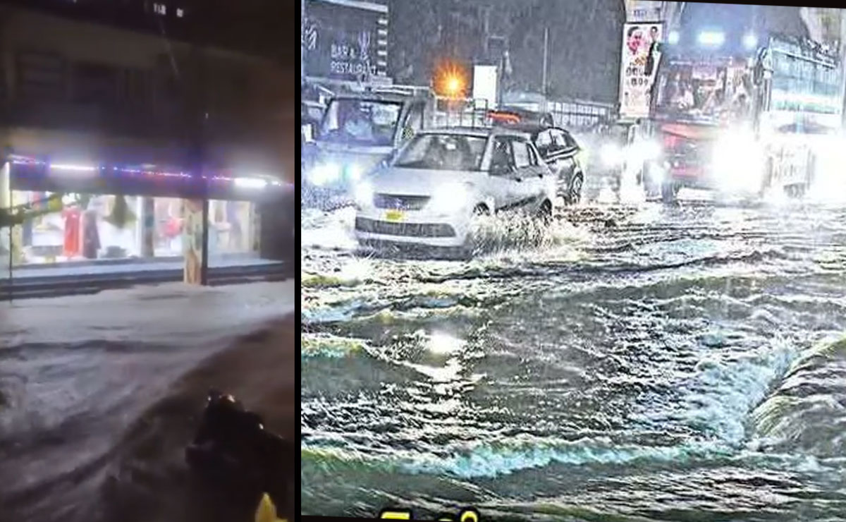
Hyderabad: Taking a bold step in response to frequent floods that hit in proximity of the Ameerpet Metro station and the Maitrivanam, the Hyderabad Disaster Response and Asset Protection Agency (HYDRAA) has announced that its plans to divert stormwater to the neighbouring Krishna Kanth Park pond area and this could well take care of the waterlogging issue that has been plaguing the city in the recent times.
Table of Contents
Hyderabad Chief Commissioner AV Ranganath under the supervision of Telangana Chief Minister A. Revanth Reddy gave a complete survey of flood-prone channels paying attention to those places that often become swollen during heavy monsoons. The Drainage network analysed by Ranganath was linked to Krishna Kanth Park and collects water in other areas like Jubilee Hills Road No. 10 , Venkatagiri, Rahmatnagar and Yangousfaga.
Also Read: Rajya Sabha adjourned till 2 pm amid continued Oppn uproar
Today, the storm water skips the pond of the park, and instead occupies the Ameerpet area by guiding through Madhuranagar that floods the straight ground in and around the Metro station, all the more aggravated by the trash and plastic litter blocking the drains. To overcome this, HYDRAA has suggested the widening of the seven-acre pond at Krishna Kanth Park to 12 acres, so that up to 120 million liters of runoff can be collected during flood-like conditions and then liberated later as the flood-situation can be diffused.
The agency is also looking at future enhancement of the 1.1-km box drain connecting the pond with Ameerpet to enable it to carry a higher discharge. There is also an added recommendation to conduct Ground Penetrating Radar (GPR) survey to identify areas of blockages and silt accumulation in the drains within the Ameerpet-SR Nagar road so that subsequent infrastructure enhancements can be planned.
The Greater Hyderabad Municipal Corporation
(GHMC) is in the process of coming up with the bigger picture containing the strategy of flood mitigation. It has encouraged consultancy businesses to draft comprehensive project reports, rainfall and discharge analysis and GIS-based cartographic analysis like drone surveys to map storm water drains, culverts and catch pits digitally. The information will be used in providing a master plan for the drainage system of Hyderabad.
These initiatives jointly represent a dual approach:
urgent temporary measures such as diversion of water and long груprogressive strengthening such as system redesigning of the drainage and geospatial planning. The objective of Hyderabad is evident, which is to minimize floods, protect urban infrastructures and make life easier in months of monsoons.